


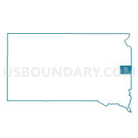
VTD-precinct 15, Brookings County, South Dakota
About
Outline

Summary
| Unique Area Identifier | 667028 |
| Name | VTD-precinct 15 |
| County | Brookings County |
| State | South Dakota |
| Area (square miles) | 71.81 |
| Land Area (square miles) | 69.55 |
| Water Area (square miles) | 2.26 |
| % of Land Area | 96.86 |
| % of Water Area | 3.14 |
| Latitude of the Internal Point | 44.44848340 |
| Longtitude of the Internal Point | -97.07710690 |
Maps


Graphs
Select a template below for downloading or customizing gragh for VTD-precinct 15, Brookings County, South Dakota


Neighbors
Neighoring Voting District (by Name) Neighboring Voting District on the Map
- VTD - Arlington city ward 1, Kingsbury County, SD
- VTD - precinct 4, Kingsbury County, SD
- VTD Estelline precinct, Hamlin County, SD
- VTD Norden precinct, Hamlin County, SD
- VTD-precinct 10, Brookings County, SD
- VTD-precinct 12, Brookings County, SD
- VTD-precinct 14, Brookings County, SD
- VTD-precinct 21, Kingsbury County, SD
Top 10 Neighboring County Subdivision (by Population) Neighboring County Subdivision on the Map
- Arlington city, Kingsbury County, SD (907)
- Norden township, Hamlin County, SD (511)
- Volga township, Brookings County, SD (383)
- Estelline township, Hamlin County, SD (324)
- Badger township, Kingsbury County, SD (199)
- Denver township, Kingsbury County, SD (196)
- Oakwood township, Brookings County, SD (189)
- Preston township, Brookings County, SD (183)
- Laketon township, Brookings County, SD (169)
- Winsor township, Brookings County, SD (159)
Top 10 Neighboring Place (by Population) Neighboring Place on the Map
Top 10 Neighboring Unified School District (by Population) Neighboring Unified School District on the Map
- Sioux Valley School District 05-5, SD (3,325)
- Hamlin School District 28-3, SD (3,314)
- Arlington School District 38-1, SD (1,915)
- Estelline School District 28-2, SD (1,589)
Top 10 Neighboring State Legislative District Lower Chamber (by Population) Neighboring State Legislative District Lower Chamber on the Map
- State House District 7, SD (24,910)
- State House District 4, SD (20,558)
- State House District 6, SD (19,896)
Top 10 Neighboring State Legislative District Upper Chamber (by Population) Neighboring State Legislative District Upper Chamber on the Map
- State Senate District 7, SD (24,910)
- State Senate District 4, SD (20,558)
- State Senate District 6, SD (19,896)
Top 10 Neighboring 111th Congressional District (by Population) Neighboring 111th Congressional District on the Map
Top 10 Neighboring Census Tract (by Population) Neighboring Census Tract on the Map
- Census Tract 9587, Brookings County, SD (4,965)
- Census Tract 9552, Hamlin County, SD (3,151)
- Census Tract 9581, Kingsbury County, SD (3,117)
- Census Tract 9551, Hamlin County, SD (2,752)